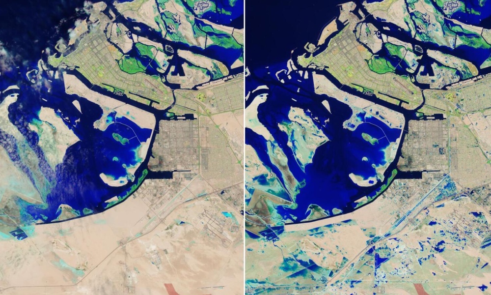
UAE: NASA releases heavy rain images of UAE’s flooded areas
The US space agency NASA has released images of flooded areas in the United Arab Emirates after heavy rains hit various parts of the country on Tuesday.
The storm system, classified as “slow-moving,” brought heavy rain across the Gulf states, with some cities receiving more than their normal annual rainfall, NASA said.
NASA noted that some areas remained flooded on April 19, when the Landsat 9 satellite flew over the area for the first time after the storm. Specifically, the images showed flooding in Jebel Ali.
Photos taken on April 19 show water covering parts of Sheikh Zayed Road, a famous thoroughfare connecting Dubai and Abu Dhabi. In addition, patches of flooded areas are also visible in Khalifa City and Zayed City, residential areas southeast of central Abu Dhabi.


